Keeills and Cake; Speke Keeill, Braddan.

Keeills and Cake; Speke Keeill, Braddan.

Keeill number thirty eight.

It may also be remarked, that besides Barrows, other reliques of antiquity of a different kind, are thickly scattered all over the Island, namely, the Kihls or small Kirks of the early Christians. These are merely small enclosed spaces, containing some mounds or rubbish, and are so numerous that it is said that every treen anciently possessed one. They appear to have been a kind of domestic chapels, and are said to have been visited occasionally by itinerating monks. To this day, tradition affixes the chaplaincy of one in Braddan named Kiel-Albin, to the proprietor of a neighbouring farm, Awhallyon. But in general, they are now entirely forgotten, and only superstitiously venerated as containing the remains of the dead, for they have all been used as burying places. As an example of one, Kiel-Vael, or Michael, which signifies Kirk Michael. situated on the top of Balladoole hill, may be pointed out as occurring on this road.  Another, near the Douglas road, may be seen on passing Bulreinny hill, Mount Murray. (Oswald, 1831, ‘Isle of Man New Guide’)


mm.jpg
1869 O.S.


I have put off writing this post for a while as unlike the other posts I have only one photo of the keeill site, somewhere I found myself particularly uninspired by, especially as it took us two attempts to find it.  I think we were expecting more than the solitary stone on the edge of a golf course which is all that marks the location in 2016.  The stone is thought to have been in place for many years and was possibly placed there to keep the plough away from the site, either to preserve it or to preserve the plough from large stones that may cause damage.

The purpose of this blog is to document all the ‘Keeills’ on the Isle of Man with existing remains in 2016 and under that description, ‘Speke Keeill’ does not warrant a post.  However, what was found during an investigation by Time Team and Wessex Archaeology in 2006 makes Speke Keeill very much deserving of a mention.

speje

The keeill site is on the land of the Mount Murray Golf Club, sitting very close to the Speke Lane boundary, the burial site continues on the other side of the lane on Speke Farm land.  Marstrander in ‘Treen og Keeill’ (1937) mentions Speke in his list of keeills on the Island but gives no measurements of the building or a known dedication.

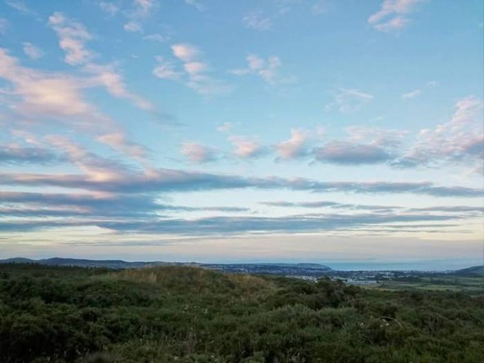
Mount Murray is a hill just outside of Douglas, in the past it was sometimes known as ‘The Mount’ and earlier as ‘Cronk Glass’ meaning ‘Green Hill’ (Gill, 1929. ‘A Manx Scrapbook).  The earliest name for the hill seems to have been ‘Ais Hólt’ which means ‘Holt’s Hill’, Holt was a Norse surname (Kneen, 1925, ‘Place names of the Isle of Man’).

In 1717, a Dublin Merchant, Richard McGwire, applied to enclose an area of common land known as ‘being the mountain called Ash hold’ and started to build a house there.  Unfortunately, he got in to debt and the estate was sold a couple of times and rented out (at one stage to Sir Wadsworth Busk, attorney general of the Island 1774-1797′) before it was bought by Lord Henry Murray in 1793 (information taken from Manx Notebook).

‘The house is elegant: and Sir Wadsworth’s fine taste endeavoured to embellish some of the neighbouring fields; but the sterility of the soil, in a great measure, has frustrated every attempt. Yet, in this retirement Sir Wadsworth devotes himself to the pursuits of literature and the enjoyment of domestic virtues.

At a little distance from Newtown, on the top of a mountain, Sir Wadsworth erected a pillar inscribed to the Queen, in commemoration of his Majesty’s recovery in 1789; which has little to recommend it to a traveller’s attention, except the loyalty it expresses. To the fishermen on this side of the island, it however proves, from its elevation, an excellent sea-mark.’ (Robertson, 1794, ‘A Tour Round the Isle of Man’)

The mound where Sir Wadsworth erected his pillar still exists although the pillar seems to have gone.


speeee.jpg
Thanks to Sam Hudson for the photo of the Wadsworth Busk mound.


The ‘Braaid Circle’, a stone circle site with the remains of a Norse farmstead was also on the land of the Mount Murray estate until it was divided up in the last half of the 19th Century.

img_20160808_200659

The first mention of the keeill at Speke, is on a Mount Murray Estate map (1800) which shows a small rectangular east-west aligned building in an enclosure marked as ‘old chapel’, this information comes from the Wessex Archaeology report for Time Team although I have had no luck trying to find this map myself in the MNH library.  It is thought that John Murray (1755-1830), Fourth Duke of Atholl and a keen antiquarian, may have made a double ditched enclosure around the keeill site, possibly to protect it, in the process the enclosure cut through one of the graves.  In recent times, the Mount Murray estate has become a golf club with a large housing estate in the grounds.

In the Ordnance Survey particulars on the site, it states;

‘ In a field to the immediate S.E. of Speke is pointed out the site of an ancient Chapel and Burial Ground. A number of stone lined graves are to be seen in the road running past the E. end of the field, and during the construction of the road a large quantity of human bones were found. There is no tradition regarding the spot.’ Authorities quoted are: Mr. John Corris; Mr. Hog g; Mr. Quine; Dr. Oliver, Douglas.’

At the time that Kermode was surveying the keeills, there were no visible remains at the site.  In the Fifth Report (1918, Kermode), it mentions that Mr Richard Lace had examined fourteen lintel graves at the site and found them ‘of the usual character’ although he had found two adult bodies in one grave which was unusual, he estimated from the burials that the cemetery would have been around 200 yards in diameter.  Richard Lace was headmaster at Santon school and an enthusiastic antiquarian who completed a number of surveys at Kermode’s request including the Sulbrick and Ballawoods keeill sites.  There are a number of letters between him and Kermode in Kermode’s private papers and we are reminded that many others share the credit for the wonderful work of the Manx Archaeological Survey.  Other than the mention of the lintel graves, there is no other information in the Kermode report.

In 1992 when the area was being developed there was a survey of the keeill site but unfortunately the records of this were not lodged with the MNH library so I wasn’t able to access it, the connected planning applications were unfortunately unable to be found.  So, very little was known of this seemingly long ploughed over site and the stone could have become little more than a marker in a round of golf.

Until Time Team happened!


llllllll.jpg
Photo used with permission from Wessex Archaeology.


The Speke Keeill was excavated by Time Team and Wessex Archaeology and the results were aired on television in 2007.  The following information on the Time Team dig I have used with permission from Wessex Archaeology and all quotes are taken from the full report on the dig which can be found here.  The project had three aims;

To characterise the archaeological resource at the site;

To provide a condition survey of the site;

To determine the extent of the site.

Underneath the layer of turf covering the site, the team found the four walls of the keeill, built in Manx slate and granite blocks which had all fallen inwards, the wall had originally been supported by a layers of turf banked up against it on the outside.  Underneath the collapsed walls, they found the original altar from the keeill, built of thin slabs of Manx slate and with the familiar white pebbles found both inside and around the altar that are often found at these sites.  No floor covering was existent which may have meant the floor of the keeill could have been hardened earth instead of the frequently found stone slabs and the door was found to have been in the south west corner of the south wall.  A roughly shaped square structure was found just outside one of the walls and was thought to be a ‘reliquary’, the inside was lined with white quartz stones;

‘This deposit was either packing for the lining (106) or positioned around whatever had been placed within the feature, perhaps a small box containing a piece of the founder’s remains. Following the abandonment of the keeill, the reliquary may have been opened and the relic removed to another location.’

It was found that after the keeill had been abandoned as a chapel, there was a period of disuse before the walls were possibly intentionally demolished or collapsed naturally.  A slate slab incised with a cross was found which may have originally been a grave marker before being reused in the structure of the keeill itself.  In one of the ditches was found an Ogham marked stone;

Ogham originated in Ireland in the 4th and 5th centuries where it continued to be used until about the 7th century.  It continued in use longer in Scotland, well in to the 10th and 11th centuries, particularly in the Northern Isles of Orkney and Shetland where there was a mixing of the Norse and native Gaelic cultures along the Atlantic west coast of Britain. Ogham is notoriously difficult to date although the development of the script is known. The earliest form of ogham was written down the arris edges of stones or timber with lines or letter strokes scribed either side (Type I ogham). Later it was written on flat surfaces with a central line or stem used to imitate the arris edge, with lines scribed above and below this stem creating bundles of letter strokes (Type II ogham).

The Ogham stone at Speke is written in a form of Gaelic particular to the Northern Isles and dates from between the 8th century and the 12th century, the inscription reads;

‘BAC OCOICAT IALL’ meaning ‘corner/angle, fifty, throng/group’


lllllllllllllllllllllll.jpg
Image of the Ogham inscribed stone at Speke used with permission from Wessex Archaeology.


It appears to have been doodling or graffiti rather than a formal inscription but was a very rare find.  A number of slate slabs with crosses on have been found at the site of the years; an incised cross was found by an Officer Cadet Training party camping at the site in 1941 and Ross Trench-Jellicoe found a slab marked with a cross at the site when conducting a study of Manx crosses on the Island in 1981.

The graves were excavated and one was found to hold a small plait of hair; an unusual find as hair is rarely preserved from that date.  Samples from three graves were sent for radiocarbon dating, these were found to all date from between the 6th and 7th centuries which made them pre-Norse and much earlier than the keeill itself.

The report suggests that the history of events at Speke Keeill is similar to that at Balladoole with a keeill being built within an earlier cemetery following the arrival of the Norse around the 9th century.  This is a situation found in several other keeill sites on the Island including Ballameanagh Keeill, Upper Sulby Keeill and Keeill Woirrey, Maughold (Lowe 1987, 78-9).  They were unable to find out the extent of the site due to time constraints but it is thought that Richard Lace’s estimate of the cemetery measuring 200 yards in diameter may have been pretty fair.


kkkkkkkkkkkkkkkkkk.jpg
An image showing the layout of the keeill and some of the finds including the ‘reliquary’, used with permission from Wessex Archaeology.


This excavation of the Speke Keeill by Time Team and Wessex Archaeology has brought life to this site and much has been learnt from their findings.

Modern technology and archaeological practice have advanced so much from the time of the Kermode surveys and one has to wonder what else would be learnt about early Celtic life on the Island if there was an unlimited resource of archaeologists and time to excavate the many ancient sites on the Island to this level.  Wishful thinking of course.

So, next time you’re playing a round of golf at Mount Murray, consider those graves you’re walking over; in the Isle of Man, there is history everywhere.

speje

lllllllllllllllllllllllllllllllllllllllllll4.jpg

More information on the Manx keeills.


Keeills and Cake; Keeill Ean, Lezayre.

Keeills and Cake; Keeill Ean, Lezayre.

Keeill number thirty three.

Keeill Ean sits in the Brookdale plantation in Glen Auldyn, the plantation belongs to the Forestry Board (DEFA) and is accessible to the public. 

There are three roads to Glen Auldyn. The first is towards Albert Tower Hill, past the foot of Elfin Glen, a very sweet wooded ravine west of the tower, and along the hill west of Clybane, a fine old Manx place, perfectly characteristic, half mansion, half farmhouse, shaded with giant elms.  The second route is by the Lezayre Road, past Milntown, and to the left up the flats by Glen Auldyn River. The third route is a riverside path from Ramsey Bridge through Greenland, also entering Glen Auldyn just beyond Milntown.  Skyhill is a beautifully wooded and very steep abutment upon the plain, of a ridge of heights standing out from the mountains. Glen Auldyn is the gorge winding between-a gorge with the wild and weird fascination of surprise and mystery. The first mile is seductive with all kinds of picturesque grace road and river gliding along flats, with nestling cottages and straggling fringes of trees and truant woodland, the afternoon sun scarce clear above the ridge of Skyhill.  On the left, in a side ravine, is the Alt or Cascade, in Manx, the Spooyt Vooar (great spout), which gives its name to Altdale corrupted into Altyn. Its Norse name was Braid Foss. The main glen narrows, assumes a wilder aspect, with increasing upward gradient, the summit of Snaefell topping the folding vista southwards. At a lonely spot three miles out the glen forks-a steep climb to the left leading to the Snaefell Road, and… to the right the hill path to Sulby. (Mate’s Isle of Man Illustrated, 1902).

glen auldyn2

Glen Auldyn is one of the most fascinating areas of the Island and is renowned for its folklore and stories, many involving ‘fairies’.  I highly recommend a read of ‘Legends of a Lifetime’ by George Quayle, this wonderful book will tell you so much about this part of the Island and really breathes magic in to it.  The glen lies close to Ramsey and was a favourite spot for visitors in the heyday of the tourist trade on the Island, it was also where P. M. C Kermode (who became the first director of the Manx Museum and was instigator and author of the Manx Archaeological Survey) and his sister, Josephine (alias ‘Cushag’), the Manx poet, lived.

glennn

There were three keeills known to have existed in Glen Auldyn.  There was Keeill Phooigyn, of which nothing remains but the memory of the name, Ballameanagh keeill (known as Keeill Ean) and Keeill Vael.  Keeill Vael, dedicated to St. Michael, is thought to have sat in a glen known as ‘Glion Keeill Vael’ but the knowledge of the site of the keeill is now lost although Kermode mentioned it as at approximately O.S., V, 14, (3243 or 3244).  Kermode in the Fourth Report of the Manx Archaeological Survey, calls the Ballameanagh Keeill ‘The Cabbal’ and he doesn’t mention the name Keeill Ean (although this is what it is known as in other publications).  There had been a custom of gathering at the keeill on St. John’s Day which suggested strongly the dedication of the keeill to St. John (Proc IoMNH&ASoc, vol3), Keeill Ean is the Manx translation.  Kermode describes the keeill site;

In a field behind Mr. Cubbon’s house in Glen Aldyn, are ruins still known to a few people as the ‘Cabbal,’ or the ‘old Chapel.’ This is in the enclosure marked V, 14 (3080) on the O.S., at a height above sea-level of 18o ft. or thereabouts. On a projecting bluff at the S. E. corner of the small field a portion of the ancient cemetery remains and part of the foundations of the keeill.

In the last half of the 19th century, a road had cut through the keeill diagonally and many stones had been removed, this is shown on a plan from the Kermode Survey:

ballameanagh

From the remains, Kermode estimated the size of the building to have been about 15 by 9ft., he found the bank against the south west corner to have been flagged with large stones, there were also traces of this at the north east and south east corners.  The exposed area of the west wall showed that the keeill had an inner and outer facing of stone filled with soil and rubble, the middle of the west wall showed traces of a doorway.  At the time of the survey, a few of the paving stones from the floor remained in place.  In the road way that had intersected the keeill, Kermode found a stone lined grave which must have been directly under the north wall, from the remains of it, it was thought to be a ‘heathen’ pre-historic grave, yet another example of a Christian chapel being built on a site that was historically sacred.  During the making of the road that cut through the keeill, Kermode was told that a bone needle and some rings were found that had since been lost, I wonder where those ended up!

They also found further evidence of burial in the triangular space to the east of the keeill.  There was folklore associated with this keeill which is mentioned in the Kermode report and also in other publications; in earlier times, a method of divining the future was practised at this keeill site.  The keeill was visited on St. John’s Eve at midnight and people watched for ‘lights’ in the glen, the number of lights seen would foretell the number of deaths in the locality of the following year.  Kermode mentions that one year, twenty one lights were seen ‘dancing’ up the glen.  That year was the ‘great epidemic’ and there were twenty one deaths, just as the lights had foretold.

A few years after the survey, the keeill at Ballameanagh was visited by the antiquarian society in 1923, the visit was led by Kermode himself (Proc IoMNH&ASoc vol2 #1), at the visit, a Mrs Cubbon remembered the site being known as the ‘Cabbal’, in fact, it was her uncle that had cut the road way through the building.  I did wonder why the whole chapel wasn’t demolished, they weren’t superstitious or they wouldn’t have destroyed it in the first place, I can only assume that to remove the rest of the keeill without the benefit of modern machinery would have been unnecessary effort.

There was a stone ‘font’ and a ‘holy water stoup’ found nearby that were thought to have come from the Ballameanagh keeill.  I found a letter (FLS Q/020-E) in the Manx Museum library from a Mrs Elizabeth Quayle to Mr Basil Megaw (the Director of the Manx Museum at the time) written in 1955 regarding a these items.  The letter notes that the owner of Ballameanagh at the time, a Mr Harry Cubbon, said that the ‘font’ had been;

…for generations in a cowhouse of a croft, to the south of the old chapel, occupied by people named Caley.  It had been used (for) holding meal and water for the cow.  The foundations of croft buildings were washed away in the 1929 flood, and tumbled in to the river from where the font was rescued by Mr. Cubbon and placed in its present position, a field to the south of the chapel.

The stoup had been used as a pig’s trough for the owners’ life time and it was noted that the property had been in the owners family for generations.  Mrs Quayle, who lived at Upper Glentrammon, had written to the museum with information and sketches of these two items, Mr Megaw’s reply was, I felt, rather patronising.  He thanked her for the sketches and notes but said that items like these were rather a problem to the museum as none had been found in the actual keeills, usually in places nearby or had been placed in the keeills by people assuming the connection.  He wasn’t sure they would have been used in the keeills as he felt that often, the ‘sacred chibbyr’ (holy well) was close by and used instead.  I’ve shared an extract from the letter below;

It doesn’t follow that these stoups are not old – some certainly are.  But their use in many cases remain uncertain, and that is what we must hope to find more about.  Meanwhile, your notes are admirable, and I hope you’ll carry on in this way now you have tried your hand at sketching!  There are lots of other good subjects too!

… The poor old museum will burst at the seams if we take in more of these troughs just at present!  We have dozens, and while I would like to accept them we just can’t cope at the moment.  We hope for more accommodation before too long, and I trust that Mr. Cubbon will be able to find a safe place for his troughs around the farm.

I wonder what happened to these interesting items and whether they ever made it to the museum, or whether they’re still holding water at Ballameanagh!

glen auldyn 3

Keeill Ean was not on our list of keeills with existing remains in 2016, it was just one we were curious about as we knew the antiquarians had visited it in the 1950’s which was recent enough for there to be a chance of us finding something.  Nicola was unable to come with me that evening and so my friend Sam came along, we didn’t really expect to find anything as it wasn’t on the list, I thought at best it would be a pleasant evening stroll.  The keeill was not shown on the 1869 O.S. map but strangely, it is on the modern leisure map which we didn’t realise until we had spent quite some time working its location out from the Kermode survey!:

bmea.jpg

We headed up Brookdale plantation which sits on the spur of land that bisects Glen Auldyn from two other smaller glens.  We followed a footpath to the right in the direction of the keeill according to the leisure map, we knew it was behind ‘Mr Cubbon’s house’ and as the footpath runs along the edge of the plantation which then slopes steeply towards the houses, we thought we were in the right area.  The problem was, we couldn’t find anything!  So we went back to the drawing board and decided to knock at the houses below; at the first house they hadn’t heard of Keeill Ean but we had more luck at the second.  The occupiers had lived at Glen Auldyn for many years but had never visited the keeill site, they were only aware of it as when they had closed a footpath on their land, there was someone who raised an objection to it closing as they used it to visit an ancient keeill!  This was useful information as it hinted at the foundations still being there, we had even more luck with an elderly gentleman in the house next door.  This gentleman had visited the keeill himself many moons ago and said it was hard to find as it was ‘behind a wall’.  With this to work from we headed back in to the plantation, we knew it must be near the end of the closed footpath, we also knew from the occupiers of house two, the areas where the keeill definitely wasn’t!  We could see the shape of the path that had cut through the keeill (from the Kermode diagram) and we used the 1869 O.S. to place the keeill somewhere inside the triangular path marked on the left of the map below;

bmeaaa.jpg

Using the old map to work out the whereabouts of the track that bisects the keeill along with a bit of hedge clambering, we eventually found what we were looking for.  Behind a boundary wall, we found what looked like a large hedge built partly with stones, what stopped us climbing back over to the path was what looked like the edge of a wall protruding from the mound.  This was the pointer that we needed, we had found the remains of part of the west wall of Keeill Ean.

ballameanagh2

We were so excited we might have jumped around a bit, sounds a bit unnecessary for a few stones but we had been looking for a few hours at this point.  Just below the wall was the remains of the lane (long unused and very overgrown) that had cut through the keeill and a few metres away, the ground dropped away just as it does in the Kermode plan.  Confirming the site was in the right field, 3080, that Kermode had said it was in (Fourth Report of the Manx Archaeological Survey), was the final triumph.

bmaaa

It is hard to imagine these remains in this dark corner of the plantation as the Keeill Ean where locals gathered to look down the valley for the telling lights, in 2016 you can barely see the light through the trees.  The site in 2016 would certainly have been unrecognisable from the days before the trees were planted when it sat on a plateau in open countrysideit would have had a wonderful view.

It seems that the keeill is still visited (or certainly until recently) by at least the person that objected to the footpath closing, however, when we had researched the keeill, we couldn’t find anyone that knew of its whereabouts so we were pretty pleased to put this keeill site back on the map by giving it a post of its own.  We weren’t able to tell the extent of the remaining foundations due to it being very overgrown, I’m pretty sure that the remaining walls of Keeill Ean are still sitting safe inside that mound.

ballamenaballameanagh3ballameanagh2ballameana5ballameanagh1ballameana5

‘Untitled’

“We are the people of the Glen,” they said,
And then, again, the Christmas darkness rang
With those old tuneful melodies they sang,
While we a welcome in their music read.
Swiftly the busy years have passed and fled,
Nor could the parting be without a pang
From all the kindliness and love which sprang
To meet us with a courtesy inbred.

O glen of roses, glen of mingling streams,
Glen of the swallows and the tender wren.
Glen of the children, glen of elfin dreams,
That lay in mystery beyond our ken;
Life all around us touched by faery gleams,
We loved with you, dear People of the Glen!

Cushag.

neryglennnglen auldyn2glen auldyn1glen auldynglen auldyn 3


I have ended the post with some of Nicola’s beautiful photographs of Glen Auldyn and the surrounding area, a wonderful place to visit.

Tell me more about keeills.


Keeills and Cake; Eairy Moar Keeill, German.

Keeills and Cake; Eairy Moar Keeill, German.

Keeill number twenty six.

With kind permission from Lord Davis-Goff and tenant farmer of Eairy Moar Farm, Ray Griffin.

Spelled in various ways as Earey Mooar/Moar, Eary Mooar/Moar, Eairy Mooar/Moar, a name that translates as ‘Great Sheiling’, the Eairy Moar Keeill sits on the hillside above Glen Helen on the land of Eairy Moar Farm.

Glen Helen, previously known as ‘Rhenass’, was planted in the 1860’s and grew in to a well known tourist attraction where locals and visitors flocked to visit the ‘Swiss Cottage’ and enjoy trout fishing, skittles, swings and excellent cheese cakes amongst many other forms of entertainment (‘Jenkinson’s Practical Guide’, 1874).  Even in the 1920’s there was plenty of fun to be had with:

…an amusement park with gardens and lawns, an aviary, dancing floor and tea gardens, and a boating lake with fountains playing, but beyond, the long glen winds so far into the mountains that it is easy to get out of sight and sound of the merry-makers. The wide glen is one of the most richly and beautifully wooded on the Island, and the Rhenass Falls, about a mile from the entrance, are in an enchanting setting of woods and rocks. (Official Handbook Isle of Man, 1923)

Glen Helen in 2016 is made up of the recently closed Glen Helen Inn and Swiss House Restaurant and a child’s play park along with the glen and Rhenass Falls, it is most popular during TT and MGP week as a viewing and commentary spot but is fairly quiet the rest of the year especially now the businesses have closed.

Hiding in a field, just above the top footpath running through Glen Helen, is the Eairy Moar Keeill.  With all the visitors to the Rhenass Falls below and the keeill sitting just off the upper footpath which was popular with Victorian tourists heading for Little London, I was surprised that I couldn’t find any mention of the keeill in the tourism literature at the time, these chapels were often popular places to visit.  I did, however, find this mention of a stone circle which must have sat close by the keeill:

Paths lead down the glen, either high up the side of the hill or close to the stream, on the opposite side to that by which the tourist came. By following the higher track, a small but perfect stone circle will be found in a field at the back of the plantation, on the Eairy Moar farm, nearly half-way down the glen. It is evidently one of the many ancient burial-places met with on the island. (‘Jenkinson’s Practical Guide to the Isle of Man’, 1874)

I couldn’t find any other reference to this stone circle so I can only assume it did not survive in to the twentieth century.  To say the keeill is hidden is an understatement, you really could walk past it without knowing it was there as the undergrowth is so thick.  Our first attempt was on a very wet day in February, it was pretty grim and we got quite lost.

eareymooar4

The second visit was in June 2016, kindly accompanied by Ray Griffin.  Ray has looked after the 300 acres at Eairy Moar for Lord and Lady Davis Goff for over twenty years, he is now 83 and still taking care of the land and his herd of highland cattle every day.

earymooar3

Ray was very pleasant company and a real character!  He didn’t know much about the keeill other than that Lord Davis-Goff was very respectful of it and intended to fence it at some stage.  Being so overgrown and hidden in the landscape, this little chapel could easily be forgotten so it was good to see that it is very much in safe hands.

earymooar77

I can find no mention of the keeill being visited by the Isle of Man Natural History and Antiquarian Society which is a pity as the write up of these visits in the local press often provides valuable information on the structure and associated folklore of these places.  However, the Eairy Moar Keeill was surveyed for the ‘Second Report of the Manx Archaeological Survey’ (1910) which does provide us with an explanation of what hopefully still sits beneath the undergrowth in 2016.

earey mooar1

The survey team found the building to measure 14 ft. by 7 ft. with walls that were between 3 ft. 6 ins. and 4 ft. wide and standing between 2 and 3 ft. high, the foundation is deeper on one side to make up for it being built in to the hillside.  Instead of the usual earthen bank faced with stone, the chapel at Eairy Moar is built from stone throughout with a high proportion of the stone being white quartz.  This is similar to the keeill at Ballahimmin which is just up the valley from here.  The proportion of quartz stone is very high although there was no mention in the survey of it having been built on an Iron Age site which is often the case when there is a large amount of quartz in use.

The doorway was found to be in the middle of the west wall, being reached by a step about 9 inches high.  There was no paving still in position but many stones were found with the corners chipped to make them more round and they could possibly have been part of the flooring.  The base of the altar remained and was 12 inches high, 2 ft. 10 ins by 2 ft. built from large stones and earth.  The skirting of upright stones round the walls had almost all been carried away.

We were not able to see if the altar still remains in place due to the thickness of the undergrowth unfortunately, hopefully its secluded position will have protected it.

Although there is now nowhere to buy cake in the vicinity, Glen Helen is still well worth a visit.  The Rhenass Falls are just as spectacular as they were when the Victorian tourists posed in front for their photographs and they have probably changed very little from when our Celtic ancestors climbed up the hill from Rhenass with the sound of the waterfall in the background to worship at the Eairy Moar Keeill over 1000 years ago.

You can almost picture the keeill as it was then, with the sun setting in the west and reflecting off the walls full of glistening white quartz; making the chapel so visible on the open hillside that it would be a landmark of the Celtic faith for miles around.

eaarymooar6earymooar5earymooar7eariymoo

What’s a keeill?

Please be aware that these sites are on private land unless noted as being otherwise and are visited with permission of the landowner.

Keeills and Cake; Sulby Keeill, Onchan.

Keeills and Cake; Sulby Keeill, Onchan.

Keeill number twenty.

With kind permission from Claire and Brian McKendry, Upper Sulby Farm.

On a bright but windy morning we headed out to Onchan to visit the keeill at Upper Sulby, one of two keeills with foundations still remaining in the Parish of Onchan.  In 1892 the IOMNHAS visited this site and found this;

’The chapel lay almost East and West, and measured inside about 24ft by 12ft.; the walls, about 3ft thick, 3.5ft high inside.  Traces of a mound surrounding the chapel could be detected.  The extent of the ruins had been reduced by a former proprietor when ploughing the “flat” or “Big Meadow”; several “old stones or portions of a sepulchre” had been removed and utilised in building.’ (Y.L.M, 2, p.4)

I had seen a photo of the keeill from the Fifth Report of the Manx Archaeological Survey taken in 1935 so we were expecting visible remains:

sulbby.jpg

The landowners had explained how to get to the remains so we made it to the field and started to search, we could see where the boundary hedge was recessed and knew it must be in the vicinity as it had mentioned in the survey that the boundary hedge followed the ancient line of the enclosure or cemetery.  The only thing was, we couldn’t see anything resembling a keeill, just one large stone on its own sitting suspiciously near to where my map reference placed the keeill site.  So we kept looking.

sulby2

After fruitlessly searching through the long grass, I gave Brian McKendry a call to see if he could point us in the right direction.  Brian has owned the farm for four years and told us of his excitement when he saw he had ‘remains of chapel and burial ground’ on his property, followed by his disappointment when he realised all that remained was a recessed hedge and a large solitary slate stone, he seemed like someone who would really look after an ancient monument so it was a real pity.  We had noticed this stone and thought it probably had something to do with the burial ground but in fact it was all that remained of the Sulby Keeill.

sulby4

The keeill was surveyed by P. M. C. Kermode for the fifth survey around 1918 and although they found a turf mound, they were disappointed to find very little left of the walling that remained:

Scarcely more than two courses being in position anywhere inside, while, of the north wall, even the foundations had been carried away.  Outside was rather better, the south wall reaching a height of four feet.

… the measurements were shown to be about 21 ft. by 8 ft.  The eastern end of the north wall remained in parts from 2 ft. to 2 ft. 6 ins. high; the east wall, 3 ft. to 3 ft. 6 ins., the south about 18 ins. (inside), and the west at its north end up to 2 ft.  They varied in width from 4 ft. to 4 ft. 6ins. on the south, and were built with an inner and an outer facing of stones with a core of earth and rubble.

There was definitely much more at the site 100 years ago!  The survey then talks about some very large stones:

Some of the foundation stones remaining inside were of good size.  On the south was on 44 inches (of which 8 ins. projected into the east gable) by 6 to 7 ins. wide and 10 ins. high; another 38 ins. by 2.5 to 5 ins. and 10 ins. high.  Between these two a smaller one had fallen forwards which was of the same height, so that we may regard 10 ins. as the level of the skirting on the south.

I’m assuming the remaining stone standing in the field is one of those that are mentioned above or one of the large stones he mentions later in the survey that marked the entrance to the enclosure.   There are no visible remains of a mound so it looks like some time over the last 80 years, the keeill has been completely ploughed in to the ground.  As the other stones from the site seem to have been removed (perhaps they were also built in to some nearby outbuildings), I can only assume that this stone has been placed on end to mark the site.

Thanks to a plan from the archaeological survey, we can see what the Sulby Keeill would have looked like:

sulll.jpg

The survey tells us that the doorway was in the south end of the west wall and that a small flagstone remained across the entrance outside, and there had been a step down in to the interior.  The altar had the lowest course still in position and was 32 ins. long by 18 ins. wide, it might have been a few inches larger if it had a facing of flags.  Further visible groundworks are also mentioned:

Outside were traces of the customary bank against the walls 4 ft. wide and on the south 6 ft. wide… From the eastern corner of this northern fence (of the enclosure), a line of about 37 yards would reach a low ridge which looks like that of the south fence of the enclosure extending to a point about 26 yards from its west boundary.  Some large stones may even mark the position of the original entrance.  The area enclosed does not appear to be definitely marked, the Keeill being set rather nearer to its south east end.

There was a lintel grave found 2 ft. from the outer face of the keeill and 75 white stone pebbles were found above the graces, some were also found near the altar.

In what appears to be a summary of the Fifth Report of the Manx Archaeological Survey (uncatalogued but in MS08979 box 2 of 2) there is an interesting write up of the Sulby Keeill from around 1918.  The author writes about the time of the excavation giving interesting insight:

‘I well remember it, on account of the distance I had to walk in the evenings, three miles out from my office at the library.  Mr Kermode did this frequently: there were then no friendly motor cars.  A lintel grave was found and several white pebbles were met with near to where the altar stood.  The face of the north wall was stripped to its foundations.  Taken altogether, it was, considering the facilities, a good examination.

I visited the site a few weeks ago, and found the keeill to be in much the same state as when Mr. Kermode finished his examination.  Sulby Farm is owned by the Rev. W. J. Karran.  He is proud, as  was his father before him, to possess this interesting relic of past. The keeill is the best preserved in the parish of Onchan.’

What a pity the future owners of Upper Sulby didn’t feel the same way!

So, the keeill at Upper Sulby no longer has any visible remains in 2016 but it still has a stone to mark the site and a recessed hedge to show us where the burial site ended.  If anyone knows any stories, history or folklore about this keeill or any of the others then please let us know by contacting us at braddangirl@yahoo.co.uk.

It is an important part of our Celtic past and although it is gone, it shouldn’t be forgotten.

sssssssulby4sulby2sulby3

What’s a keeill?


Keeills and Cake; Knock-e-Dhooney, Andreas.

Keeills and Cake; Knock-e-Dhooney, Andreas.

Keeill number seventeen.

With kind permission from Dave Martin, Knock-e-Dhooney.

On a beautiful May evening, we headed up to Knock-e-Dhooney in Andreas to meet Dave Martin who had kindly agreed to show us around the Knock-e-Dhooney Keeill.  The Martin family have been at Knock-e-Dhooney since at least 1450 and it was wonderful to have a guide who knew so much about the keeill and the surrounding area.  This is the only keeill with existing visible remains in the Parish of Andreas.

 The chapel is thought to be very early, perhaps as early as 400 – 600 AD and sits in the middle of a field next to the farmhouse.  It has been well maintained and fenced and is under the guardianship of the Manx Museum and National Trust who cut the grass inside and keep the fence in good order.  The keeill walls are fairly high, internally there seems to be a fair amount of infill raising the height of the floor, perhaps it is tumble from the upper sod part of the walls or the detritus from the excavation.  We sat down in the keeill with some delicious orange cake and Dave told us a bit more about the history of this area.

ked3
Dave Martin sampling keeills and cake.
Dave pointed out that to modern eyes it is an unusual choice of site for a keeill as it is very exposed with no shelter, there’s no water nearby and it’s not very visible, there are plenty of other sites nearby that would have been more obvious choices.  Dave Martin is very interested in LiDAR which is a form of digital surveying that uses lasers to map areas in great detail.  Using this, he was able to show us how the keeill was actually only visible from very small areas of the north of the Island, unlike the site of the Viking boat burial close by that is very widely visible.  It would seem that the emphasis is on it being more important as a place of worship for the locals and not on it being seen from afar as a form of outreach.
Dr Larch Garrad said that at the time period when all the keeills were in use, there were far fewer trees and each keeill was in the sightline of another, it would be fascinating if this could be proven – digital archaeology may have the answers!
It has also been suggested that this keeill was perhaps the pilgrims’ last holy place to call at before sailing over to the Abbey at Whithorn but it is unlikely that this will ever be anything more than speculation.
The walls of the keeill in 2016 are very thick, 3-4ft wide in places and some of the stones are very large and not found locally, they must have been dropped by the ice-age glaciers.  Some of the stones appear to have been tidied up and there were also socket stones made for a door so it is a complex structure for the time and would certainly be a job for more than one person, it seems to have been a community effort.
Although Knock-e-Dhooney was surveyed by P. M. C. Kermode for the third report in 1909, the survey was restricted to the keeill itself and not the surrounding area.  This is what generally happened in the Manx Archaeolgical Survey due to time constraints and financial limitations.  In 1945/46 when digging a pipe to bring water to the farm, human remains were found quite far away from the keeill at the far side of the field, they were not examined and were reinterred under the pipe.  They would seem to have been far outside the chapel boundary although it could be that these may have been a separate burial from a different time period or one that was specifically outside of the ‘consecrated area’.  In the Sixth Report of the Manx Archaeological Survey (1968), Mr J. R. Bruce writes that:
… where the keeills had no successors, and their burial sites reverted to agricultural land, it was not unnatural for the farmer to demur at the use of his land for burial, especially as there was a belief, devoid of legal warranty, that a path once used by a funeral party became a right of way, but this did not prevent the occasional use of a field border for clandestine burial, protected by a few slabs of stone, as several instances have revealed.  In Arbory Parish, I have been credibly informed by an old farmer that, in his grandfather’s day, it was not unknown for the burial party, intent on a ‘keeill burial’, to perform their task at any available point ‘from which they could see the old place’. 
This is very interesting but possibly not relevant to the Knock-e-Dhooney field burials as these lie even closer to the farm house than the keeill itself.
To look at the wider context, Prof. Mark Noel and Dave have embarked on a geophysical survey of the area around the keeill and this is already revealing hints of now invisible long term occupation (their surveys are fuelled by Eccles Cakes rather than home baking though!).
keddd
Plan of keeill taken from Manx Archaeological Survey.

Kermode excavated the keeill at Knock-y-Dhooney for the Third Report of the Manx Archaeological Survey (1911) and found it to measure about 17ft. by 11ft. with walls that were between 3ft. 3ins. and 4ft. 6ins. in width and built of shore boulders, mainly granite, the boulders on the lower course were good size and well fitted.  The inner and outer face of stone were packed with sand and rubble.

A large stone was found, almost 38 ins. long by 27 in. high and between 10 and 14 in. thick, this stone stretched from the south corner to the doorway in the west wall which was 5ft. 2 in. wide.  The walls were between 2ft. 6in. and 3ft. in height and the familiar embankment of earth and stone was visible outside.  The survey team found rebates in the wall in which the door would have been set and two worn socket stones were also found.  There was a pavement slab from which was a drop of 3in. to a cobble pavement in the narrow part of the doorway.

They found the remains of the altar against the east wall, this was made up of a large slab, plain and undressed and measuring 2 ft. 9in. long by 15 to 20in. wide and around 3in. thick.  This was neatly fitted in to an upright slab on the south side although the front and north side slabs were gone.  This was the first altar to be found with its covering slab still in position at the top and showed that the overall height was only 24in.  Kermode suggested it was possible that a portable altar may have been brought by the priest to sit on top of this stone but even then it wouldn’t be very high.  The two photographs below show the altar as we found it in 2016 and at the time of the excavation by Kermode in the early twentieth century.

ked5kyddd

In the excavation, they also found a large number of white shore pebbles and several worked flints, the floor paving had long gone with the exception of a small area at the doorway and around the altar.

With the rough and ready way of excavating, it was lucky that Mr. Martin the landowner, noticed a boulder with a plain Latin cross carved in to it, amongst the loose stones ‘thrown out of the keeill’.

The most important discovery made by the survey was a carved stone pillar with a bi-lingual inscription, three lines in Latin on one face and a Celtic inscription in Ogam characters along the edge.  The Latin inscription reads:

AMMECAT FILUS ROCAT HIC IACIT
(Ammecat son of Rocatus lies here).


The photographs (taken by Mr G. B. Cowen) show the two inscriptions on the stone (the Ogam inscription echoes the Latin) and were taken from the Third Report of the Archaeological Survey.  The stone which measured 5ft. 9in. by 17 to 10in. wide and between 8 to 10in. thick, is now in the care of the Manx Museum.
Dave Martin told us that P. M. C. Kermode when speaking to his grandparents, had told them that someone had told him that Ammecat was a Prince, son of an Irish King and that he had been killed when invading the Isle of Man.  This is a verbal source and to date Dave hasn’t been able to find written confirmation to back this up.  However, the stone was found facing downwards and Dave wonders whether his ancestors possibly turned the stone upside down as they didn’t want to desecrate a grave but also did not want to venerate an invader!  Having spent some time facing downwards, the inscription on the stone had been protected and was in much better condition that it would have been if it had been open to the elements.

As if the keeill wasn’t fascinating enough, there is also an impressive Viking boat burial on Knock-e-Dhooney.  It is interesting to think that although the keeill would have been in use when the Viking burial took place, the Vikings who were generally pagan did not destroy this Christian site and instead made the decision to bury their dead nearby and within sight of it.  This could be seen to be a sign of the Vikings accepting the Celtic Christianity of the locals, that there was no human sacrifices in the ship burial is another sign of the gradual change in beliefs and traditions that was taking place.

Dave had a Viking cloak pin that his father had found on the land, it was lovely to look at it close up, especially when sitting on the top of the burial mound!

ked6.jpg


So much history in one small area, such a privilege to share it!


ked4
Knock e Dhooney Keeill.
ked2
The view from the Viking burial mound looking over at the keeill and the farm house.
ked1
The view from the keeill.

On Saturday 8th October 2016, Dave Martin will be leading a guided tour of Knock e Dhooney Farm for the Isle of Man Natural History and Antiquarian Society as part of the MNH Open Weekend events, for more information check out their website or book your place on the tour by contacting heritageopendays@gov.im

What are keeills?


Keeills and Cake; Cabbal ny Cooilley, Bride.

Keeills and Cake; Cabbal ny Cooilley, Bride.

Keeill number sixteen.

With kind permission of Mr and Mrs Teare.

Cabbal ny Cooilley (Chapel of the Nook) sits between two farms and is not easily accessible making it probably one of the least visited chapels.  We were looking forward to visiting it as it is one of the few remaining antiquities in the Parish of Bride and the only surviving keeill.

In a letter written to the ‘Manks Advertiser’ in 1826 by a Mr C. Radcliffe, he draws attention to the many keeills that still remained at the time and their plight, he described some of the sites that he remembered himself and appealed to his fellow countrymen to make a complete list of the remaining antiquities but his appeal fell on deaf ears.  He mentions that:

‘In Kirk Bride there is an estate called Ballakeeillmean, from Keeill Mean, probably St. Matthew ; in Manks : and Keeill Vael, in the same parish, if I remember right, dedicated either to Michael the Archangel, or St. Mael or Mel, one of the disciples of St. Patrick, by whom his life was written. Keeill Thraie, i.e., the Church of the Strand, from its situation near the sea-coast. Cabbal-ny-Guilcagh—whether the estate takes its name from the Chapel, or the Chapel from the estate, I cannot conjecture, and there is Keeill Thusjag, dedicated to St. Thusag from whose hands St. Patrick receieved the holy sacrament when on his dying bed…

I wish some of my countrymen, who have leisure, would be at the pains to make out an accurate list of the venerable ruins of these places where their ancestors offered unto God, through Christ, the sacrifice of prayer and praise. They are gone to their long home, and the very places where they worshipped the God that made them, and which are now so many heaps of ruins, should possess no common share of interest in the minds of that posterity.’

The Keeill Mean, dedicated to Matthew is likely to be Cabbal ny Cooilley as Ballacamaine probably comes from Ballakeeillmian (‘Place names of the Isle of Man’, J. J. Kneen).  These are extracts from the letter that can be found in the newspapers and periodicals section at www.imuseum.im.  There are many keeill sites mentioned that are long gone but because of this letter their memory remains, if only more people at the time had been as forward thinking as Mr. Radcliffe!

By the time of the Third Report of the Manx Archaeological Survey in 1911 there are five keeills (not the same five mentioned in the letter) noted as being in the parish of Bride:

  • Ballamooar which was long gone by the start of the twentieth century.
  • Port Cranstal, the site of which was cut through to make the road to the Ayres leaving no remains.
  • Ballawannal, which had been long since ploughed over.
  • Ballavarkish, dedicated to St. Mark, a mound remained at the time of the survey along with some stones but no structure.  When it was surveyed, some interesting items were found including an intricate carved sandstone window and a beautifully carved cross slab (images taken from Manx Archaeological Survey, 3rd Report):

The fifth keeill mentioned is Cabbal ny Cooilley, then on the land of Ballacamaine.  You can almost sense P. M. C. Kermode’s disappointment when you read that the landowner would not allow the site to be disturbed:

CABBAL NY COOILLEY,

Ballacamain. This is marked on the O.S., III, 10, (1019). It lies about 700 yds. North-West of Ballachrink house and 700 yds. West of the highroad to Bride, at a height of too ft. or thereabouts. We regret that we were not allowed to examine it. From the appearance of the ground it seems doubtful if there is anything of the walls remaining, but we had hoped by excavating to have been able to judge the dimensions and possibly to have made a Plan. It is unfortunate that the superstition which prevents the orderly examination of some of these Keeills for the purpose of placing on record, for the information of those who come after us, such particulars as may still be gleaned of their character, structure and appearance, and of bringing to light any monuments buried in their ruins, has in no case availed to prevent their total ruin and subsequent destruction. These monuments and remains are all the evidence which has come down to us of the history of the people by whom they were erected, and of the conditions under which they lived, and even if the refusal to allow of their proper exploration were likely to preserve them, which it certainly is not, to keep them buried beneath the surface, and forbid their examination for the purpose of record, is as useless as to cart them away. We can only hope that in course of time, as the results of our work become better known, we may meet with more general support in this respect, and that a more active interest will be taken in the proper preservation of the little that does remain.

Although unfortunate for the survey team, there is a strong folklore of bad things happening to people who have interfered with the keeills and I can absolutely understand someone almost 110 years ago having second thoughts about it.

Mrs Teare, the current landowner, mentioned that her husband thought it may have been surveyed in the 1950’s and was very curious to find out more.  After looking in the museum library and speaking to Andrew Johnson (MNH), it seems there is no record of any survey having taken place and looking at the date, it is likely that it was the Ordnance Survey team mapping the site.

When we eventually found the keeill after originally searching in the wrong field (thanks to my incorrectly marking the map reference), we found a very large mound measuring around 50ft. in diameter and between 4 and 6ft. in height, there were two large stones on top, one standing up, one lying down. In the Third Manx Scrapbook (Gill, 1963), the larger stone is mentioned:

‘Cabbal ny Chooilley, “Chapel of the Rear Part,” is the local name for the ancient Keeill in the field called Creggan ny Chooilley on Ballakermeen.  “The big stone that the Ballakermeen man took away for a gatepost, but he got no sleep that night and put it back first thing next morning,” is pointed out on the mound of the chapel.’

Of course, as Gill rarely references anything, I’m not sure where he got that story from!

Although there was a little wear on the mound at one side, no other stonework was visible and we were unsure whether the keeill building had sat on top of this mound or was interred inside (similar to Keeill Pharick a Dromma).We sat on one of the stones with a cup of tea and ate some delicious banana cake that Nicola had made, we admired the view and wondered exactly what we were sitting on.

bride1

The lack of archaeological excavation means that it would seem that this site is still intact and a mystery, who knows what lies beneath!

Hopefully, one day someone will find out, know any archaeologists with time on their hands?

bride5bride4bride3bride2

More about keeills.


Keeills and Cake; Corrody Keeill, Lezayre.

Keeills and Cake; Corrody Keeill, Lezayre.

Keeill number fifteen.

With kind permission from Danny Creer, tenant farmer, Corrody.

This quiet spot high above Tholt y Will is a favourite of Nicola’s as her family, the Christians and the Mylecharaines, farmed here for generations.  The area is steeped in history and there are two very interesting tholtans (ruined buildings) on the site, ‘The Creggans’ and ‘The Corrody’.

The name ‘Corrody’ was originally from ‘Corrony’, a corruption of ‘Ciaran’ an early Christian saint, it is possible that St. Ciaran was the dedication for the keeill.  This is suggested in an article in the Mona’s Herald on a visit to the site by the Antiquarian Society in 1953 (www.imuseum.im):

corroddddddy

The name of Mylecharaine comes from the Irish Gaelic meaning ‘Mac Giolla Ciardin’ – son of Ciaran’s servant (‘The Place-Names of the Isle of Man With their Origin and History’ by J.J. Kneen, 1925), this means Nicola’s family may have a much longer association with the area than she originally thought!

At one time this area was full of hill farms and would have been a large community.  It is hard to imagine that now, as in the 21st century The Corrody seems very isolated.  If you sit at the keeill and look across the valley, you can see many ruined farmsteads all sitting at around the same height.

From the 1820’s onwards there was mass emigration from the Island, especially the north, life was hard and after the enclosure of the common land in the 1860’s there continued to be large numbers of people leaving the Island up until the early 20th century.  This article from the ‘Manx Sun’ written in 1852 (www.imuseum.im) gives a very touching description of those leaving who knew they may never see the land of their birth again:

Emigration – The natives of the northern part of the Island are again making arrangements to leave the place of their birth and seek a home in North America. On Wednesday last about fifty persons, principally young men arrived in Douglas from Andreas, Ballaugh etc. and the same night took their departure by the King Orry for Liverpool with the intention of emigrating to America where the most of them have already friends or relatives. We are informed by a person who accompanied the emigrants to Douglas that the scene when these parties were leaving their homes, was truly affecting. Their relatives followed them for a considerable way on the road, lamenting their departure whilst a long procession of carts conveying the luggage moved slowly along and also bearing the juvenile portion of the party amidst the silence of those about to leave their native soil, who would occasionally steal an expressive glance at their late homes. Our informant says that he never saw even a funeral procession move with more touching solemnity. There were also a few individuals from the South of the Island who left by the same steamship en route for Australia.

As someone who volunteers at the Isle of Man Family History Society Library helping people with their genealogy research, I am often amazed by the real affinity to the Island that people feel whose ancestors left the Island almost 200 years earlier.  I think often about how much these economic migrants must have loved and missed their Island home, to have passed this strong feeling on to so many future generations.

The stories of mass emigration from the north of the Island and the remaining farmsteads could fill a blog on their own.

corrodykeeill

The Corrody keeill lies in a field known as ‘Cronk y Keeillee’ which translates as ‘hill of the keeill’, and seems to have been built on the remains of a Bronze Age burial site, the structure of which is still visible surrounding it.  The foundations of the keeill are still visible and in about the same condition as it was described a century ago, there is a holy well in the next field that is known as Chibbyr Karrin (Ciaran’s Well)

corrody5 (2)

The keeill was surveyed around 1915 for the Fourth Report of the Manx Archaeological Survey, they found that:

The Keeill had been set on a low and partly artificial mound, now two feet above the level of the field, roughly circular but here and there encroached upon by the plough, and having an inside diameter of about thirteen yards; surrounded by stones set on end with remains of an outer circle of stones at 3 to 6 ft. from the other. The largest of these stones was at the E. end and measured thirty two inches high above the surface of the ground by 22 to 24 inches. The general appearance suggested a pre-historic burial-place, and the cinerary urn now found proved it to have been used as such in the Bronze Age before it became a Christian Cemetery.

The plans below are taken from the survey and show the keeill in relation to the Bronze Age remains followed by a plan of the keeill itself as they found it:

crrrrrrr


corrplan.gif

Fig. 4. Keeill on Corrody, Sulby, Lezayre.

The keeill, when surveyed was 17 ft. 6 ins. by 9 ft. and ran N.W and S.E, the walls were between 24 and 40 inches high and between 3 and 4 foot thick.  The doorway was in the north wall and there were some ‘jamb stones’ remaining for openings in the walls – probably windows.  Only one or two paving slabs remained and the was no sign of an altar, there was some stone skirting along the lower courses of the walls.  There was surprisingly little information.

The photograph below is taken from the survey and shows the stone skirting in more detail:


cprrrrrr.jpg
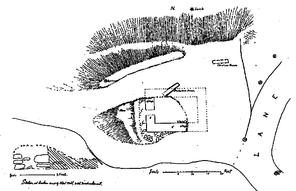
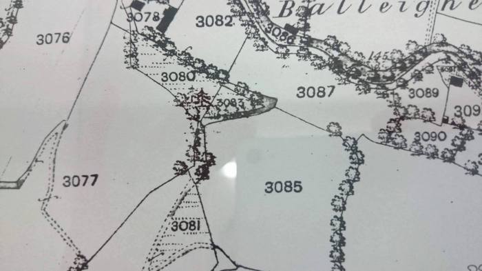
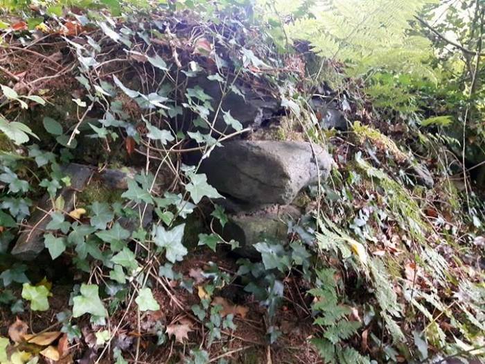
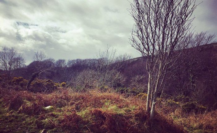
Fig. 5. Walls of Keeill, Corrody, showing stone skirting.

There are some wonderful recollections of life and folklore at ‘The Corrody’ by Alfred Christian (Nicola’s great grandfather) that were collected for the Manx Folk Life Survey in the mid twentieth century.  These documents are available at the Manx Museum Library and well worth a look, they are absolutely fascinating.  This keeill is well worth a visit as a good example with a great view, I can also highly recommend the cake at Tholt y Will tea rooms just down the road!

I’ll finish this with the most lovely poem by one of my favourites, ‘Cushag’, Josephine Kermode, who was the sister of P. M .C Kermode (Manx Museum and National Trust) and who was known with fondness as the best loved poet of her generation:

THE THOLTAN

LONE little tholtan, left by the wayside,
Where have they wandered that loved thee of old?
Where are the children that played by the fireside?
Poor little chiollagh, forlorn and cold!

Mutely thy gables are standing asunder,
Rafterless, ragged, the ruin between!
All that was homelike, secluded and tender,
Stripped of its sheltering thatch is seen.

Why have they left thee so drear and forsaken,
Was it misfortune, or sadder unthrift?
Was there a stone of the Church in thy building
Secretly working to send them adrift?

Was it the dream of a new Eldorado
Lured them away with its roseate hue?
Only to find the green hills of the distance
Bare as Barooil to the nearer view.

Come winds of Autumn and cover it gently,
Poor little hearth-stone deserted and bare;
Cover it softly with leaves from the woodlands,
Lap it away from the cold bleak air.

Hasten the day when those desolate gables,
Holding their secret of failure and dearth,
Gently shall sink to their grave by the wayside,
Hidden at last in the warm kind earth.


corrodykeeillcorrody1corrody2 (2)20160516_120755.jpgcorrody7corrody6corrrrrrrrrrr

You may have noticed that in many blog posts, I have used information from the Isle of Man Natural History and Antiquarian Society visits and journals, the society is still going strong with lots of interesting talks and visits, you can find out more at http://manxantiquarians.com/.

More about keeills.


Keeills and Cake; Cabbal Pherick, Kirk Michael.

Keeills and Cake; Cabbal Pherick, Kirk Michael.

Keeill number fourteen.

Cabbal Pherick is one of the better known Manx keeills, it is situated in Glen Mooar near Kirk Michael, next to the Island’s highest waterfall, ‘Spooyt Vane’ (meaning ‘White Spout’).

received_10154356806076354.jpeg


This early chapel is one of many dedicated to St. Patrick across the Island and is in a very lovely but lonely location in one of our Island Glens.

received_10154356798256354

We visited when the sun was low in the sky and dappled sunlight made this holy place very beautiful in the early evening light.  In the background we could hear Spooyt Vane waterfall far below and it would have been very peaceful if it wasn’t for the two year old.  We had picked up some fish and chips in Peel on the way out and they were still hot when we had got to the keeill so we sat in this delightful spot and had our tea.  Keeills and Chips.

spooytvane3

Cabbal Pherick sits in a clearing and is comparatively large, measuring 23ft by 13ft.  The walls still stand quite high in places but I think it has deteriorated slightly since it was surveyed in 1911 for the Third Report of the Manx Archaeological Survey.

spooytvane5

When it was surveyed, the altar stone was removed and placed to the right of the gate at Kirk Michael Parish Church.  The remains of the culdee’s ‘cell’ are still to be seen at the south west corner which makes it particularly unusual.  The plan showing both is from the survey:

cabbaloherickk


I came across a slightly horrifying story about the last incumbent of the keeill and cell in the the Ramsey Courier, describing a visit to the keeill from the Antiquarian society in 1954 (www.imuseum.im):

spooytvane (2).jpg

This story is also mentioned with more detail in the report for the survey team in 1911:

It is told of this Keeill that the last Priest who officiated in it was guilty of mending his carranes on a Sunday, and in consequence, met with a sudden and dreadful end. The story as told by the late Mr. Cannell was as follows: “The priest of Cabbal Pherick, at the Spooyt Vane, was a cobbler to his trade. One day he was so busy mending a pair of shoes that he did not notice the people passing in the road and looking at him in surprise. His housekeeper came to him at last and said ‘Are you not ashamed to be doing work on the Sabbath and all the people waiting at the Chapel for you.’ What are thou talking of woman,’ he said, ‘Go and count the eggs and see how many are in the nest.’ For the priest had a hen which laid an egg every day and they were collected only once a week, and that is how he knew what day it would be. So the woman went, and when she came back she said-Seven eggs there are.’ Then the priest threw down his tools, and rushed away with such haste that he fell down the Spooyt Vane, and was drowned. And the people never used the Chapel any more.” Another version lays stress on the fact that he waxed his shoe-laces, and when he was crossing the stream he tripped ever them and was carried down the fall !

I’m not sure whether the story was ever based on fact but I’m sure it was a great teaching tool for the people living nearby on the importance of keeping the Sabbath!

The photo below of Cabbal Pherick being excavated was taken from the report of the Third Report of the Manx Archaeological Survey in 1911, the photo itself was taken by Mr W. Skillicorn.  As you can see from the slightly chaotic look of the pile of stones in the middle of the keeill, I don’t think the excavations were carried out quite as carefully as they would have been today! I was told that local men were brought in to do the majority of the digging and it was overseen by Mr Kermode and the other members of the team, a rough and ready way of working.

cabbaaalpheric.jpg

In 1911, the survey found the keeill to measure 23ft. by 13ft. and the walls stood between 28in. at the west end to 40in.at the west end.

spooooo.gif

Fig. 3. Cabbal Pherick, Michael.

They found the doorway to be 25 in. wide and situated in the west wall, there was a 12in. high step leading in to the keeill from the outside.  Several pavement stones were in position at the east end and parts of the altar remained, the bed of a window on the east wall was still visible although the sill and jamb stones had gone.

The walls were the usual inner and outer face of stones, set without mortar and the space filled with soil and rubble.  P. M. C. Kermode found a small flat stone lying on its face by the doorway, on it was a very simple linear cross, a simple mark for the simple Celtic faith, this little cross is now in the ownership of the Manx Museum.  The enclosure measuring about 32 yards north to south and 25 yards east to west, was surrounded by a low embankment of earth and stones between 4 and 6ft. wide.

cabbbbb.gifFig. 6. Cross-slab from Cabbal Pherick, Michael.

Go out there, experience this peaceful place and think of over 1000 years of history at this site.  Think of the many Victorian tourists that passed on their way to visit Spooyt Vane, think of the many families that came here to share important times in their lives when it was in use as a place of God, think of the many people who have visited here over the years to reflect on their lives and enjoy the solitary beauty of this place.  Don’t think about the poor hermit with his slippery shoes, that’ll only ruin it!

And bring a picnic, or at least cake.

spooytvane6spooytvane5spooytvane4spooytvane2spoooot.jpg

More about keeills.


Keeills and Cake; Keeill Vreeshey, Marown.

Keeills and Cake; Keeill Vreeshey, Marown.

Keeill number thirteen.

Keeill Vreeshey has an access agreement in place with the Manx Museum and National Trust.  Even with this in place, people should respect the farmer and use discretion: if there’s a standing crop approaching harvest, stay away.  If there’s a single path through the crop, use it and don’t beat down any more.  Sometimes it rotates to pasture, so people should respect any livestock, close gates etc.  Keeill Vreeshey is situated on the Mount Rule back road at the junction with the Eyreton Road and is marked on the map.

vreeshet

This keeill and burial ground, dedicated to St Bridget, sit fenced off in the middle of a vast field overlooking Crosby.  The keeill has a good structure still with walls that are over four feet high in places.  Judging from the number of times that it is referred to in the Manx press over the years, Keeill Vreeshey seems to have been one of the most frequently visited keeills by antiquarian societies and similar, probably because it is also one of the most visible and easily accessible.  There was mention of a well, Chibbyr Vreeshey, in the field below, that had an association with the keeill and until the twentieth century used to draw people from all over the Island on account of its healing properties.  I found this information from a newspaper article in the Isle of Man Times from 1937 about a visit to the keeill by an antiquarian society (www.imuseum.im) but I haven’t been able to find any further information on it and it seems doubtful that it still exists.

The chapel was surveyed in 1908 in the First Report of the Manx Archaeological Survey, they found it in a comparatively good state of preservation and that is the same today.

keeillvreeshey

FIG. 3. — Plan of Keeill Vreeshey, Marown.

In the survey by Kermode and his team, they mention that the keeill is in ‘The Chapel Field’ which, according to Paul Bridson (Yn Lioar Manninagh,” VOL III, p. 433), as in 1861 known as Garey Keeill Vreeshey.  The name was forgotten by the time of the survey but they found one man who knew the fied as ‘the Breesh’.  They found the keeill to measure 16ft. by between 9 and 10ft., the wall was as high as 5ft. in places and the doorway was between 18 and 24in. wide, situated in the south wall.  The sides of the doorway were found to be of large stones with a stone on edge at the threshold of the doorway from which the pavement sloped outwards.  The position of the altar at the east end is marked by some small stones, the sill of a window 18in. wide remained in the east wall.  Directly behind the altar was a stone set on edge to cover a recess in the wall that was 18in. deep, 16in. high and 12in. wide, this is thought to have been perhaps a reliquary that may have contained the remains of the priest responsible for creating the site or perhaps as a safe place for holy items during Viking raids, this feature was also found at the nearby Cabbal Druiacht, Glen Lough.

On the outside of the walls, there was the familiar bank of earth and large stones up to the height of about 2ft. and about 3ft. wide at the base.  The irregular stones that paved the floor were still in existence.

The keeill sat in the north west of an oval shaped enclosure that measured around 58ft. by 40ft., the embankment was of earth and stones and was between 4 and 6ft. wide with an absence of stones opposite the doorway of the keeill and the remains of a pavement leading half way down to it which would suggest that it was the entrance of the enclosure.

The surrounding wall of the enclosure has long been ploughed over in 2016 but the keeill remains in excellent condition.  Keeill Vreeshey may not be as much of a ‘hidden place’ as many of these sites are, but it is an interesting place to visit and a good example of a well looked after keeill, the views across Marown are also lovely on a good day.

There are many good walks from here over the Millennium Way or along the Mount Rule back road to Baldwin, it would make a good spot for some tea and cake (of course) as part of a longer walk.

keeillvreeshey3keeillvreeshey1

More information on keeills.

Keeills and Cake; Ballacarnane Keeill, Kirk Michael.

Keeills and Cake; Ballacarnane Keeill, Kirk Michael.

Keeill number twelve.

With kind permission of Mr John Cannell, Ballacarnane.

ballaca.jpg

On yet another wet Manx morning, we made our way out to Ballacarnane Farm, a site sitting high above the Peel to Kirk Michael Road with a magnificent view down the coast to Peel.  We were there to visit the remains of the Ballacarnane keeill but we were in for a very pleasant surprise, being fortunate enough to have a guided tour from Mr John Cannell, the landowner himself.

Mr Cannell’s family have farmed Ballacarnane for over 500 years (one of only three families in the Island who have farmed the same land for that length of time).  He was a wealth of knowledge and an anthology of stories, spoken in a guttural Manx dialect that is so rare these days, his use of dialect words in conversation was worth the visit alone!  We were a willing audience and could happily have stayed all day.

Mr Cannell told us of a relative, also a Mr John Cannell, who had been the focus of a press gang attempt in Peel in the early part of the 19th century.  Mr Cannell was stronger than the men from the press gang and threw one of them in the harbour, he ran back to Ballacarnane and spent a month living in the scrub in a field with views across to Peel, waiting for the boat of the press gang anchored in the harbour to leave.  The injured party from the press gang found of his whereabouts and came to Ballacarnane to give Mr Cannell his comeuppance, however, it didn’t pan out the way he had wanted to and it is said that this poor gentleman came off worse and is buried under the foundations of the ‘new’ farmhouse!  The murder weapon is still in the possession of the Cannell family, carved with the initials and the date.  You can imagine, it was easy to forget why we had come to visit in the first place.

The farm itself is full of history; there are carvings of ‘Nickeys’ (Manx slang for a fishing boat) in the door of one of the outbuildings, etched by the fishermen generations ago who came to work on the farm in exchange for their board and lodging when the fishing wasn’t in season.  Mr Cannell was kind enough to take us to see the second ‘chapel’ on his private land, Kerrowglass Wesleyan Methodist Church which was built by John Cannell (an ancestor of the current Mr John Cannell), in 1833 on Ballacarnane land.  Although it appears very isolated in 2016, it originally served quite a large community with many more families living on the uplands: in 1851 it had an average attendance of 60.  When the chapel closed in 1963, the family locked the doors, leaving it as it was at the last service.  We really did enjoy visiting this little chapel as much as we did visiting the keeill itself.

kerrowglass.jpg

So, let’s get back on track, there are too many wonderful diversions at Ballacarnane.

The Keeill, what do we know about it?

The keeill at Ballacarnane is one of just six that are known to have existed in the parish of Kirk Michael, only two of these have visible remains in 2016, the other is Cabbal Pherick at Spooyt Vane.  The remains sit very close to the current farm house on an outcrop of rocks 200ft. above sea level, known as Cronk ny Killey (Hill of the Keeill).

ballacarnane11


The keeill is one of many that have no known dedication and it is surrounded by a burial ground.  In 2016, little stonework is visible except for one large stone at the entrance to the ruin which had at one stage been removed and put in a hedge but was replaced by the current owner’s father in as close a position as he could get to where it was originally.

ballacarnane13

Mr Cannell told us that many years ago, the owner of Ballacarnane, a distant relative, decided to destroy the burial ground surrounding the keeill by pulling up the large stones and his seven sons assisted him in this, his one daughter and her mother were very against the idea.  Within a year, all seven sons and the father had died.

The farm was left to the remaining child, the daughter, who married a Cannell from the adjoining farm and continued the family line at Ballacarnane.  There are many stories of similar happenings in connection with these ancient holy sites; exactly the same story was said of Keeill Coonlagh at Ballachonley Farm, in the parish of Jurby, it is told that the seven sons died after completely destroying the keeill and the daughter was left the farm (Third Report of the Manx Archaeological Survey, Kermode), it’s always the women with the common sense!

Alan Radcliffe from Ballayockey Farm, Regaby, told me recently that after the Ardonan Keeill was destroyed in the 1950’s, the gentleman who had taken the structure apart was badly injured by his own tractor.  Even in the mid twentieth century it was blamed on his part in the destruction of the keeill.

It seems that superstitions such as these were a real problem for the survey team.  In the Third Report of the Manx Archaeological Survey it is written:

It is unfortunate that the superstition which prevents the orderly examination of some of these Keeills for the purpose of placing on record, for the information of those who come after us, such particulars as may still be gleaned of their character, structure and appearance, and of bringing to light any monuments buried in their ruins, has in no case availed to prevent their total ruin and subsequent destruction. These monuments and remains are all the evidence which has come down to us of the history of the people by whom they were erected, and of the conditions under which they lived, and even if the refusal to allow of their proper exploration were likely to preserve them, which it certainly is not, to keep them buried beneath the surface, and forbid their examination for the purpose of record, is as useless as to cart them away. We can only hope that in course of time, as the results of our work become better known, we may meet with more general support in this respect, and that a more active interest will be taken in the proper preservation of the little that does remain.

The Cannell family are determined that the keeill should not be disturbed (and can you blame them?).  I was surprised to find that it had been archaeologically surveyed for the Third Report of the Manx Archaeological Survey around 1911.  Many thanks to Ean Cannell who kindly shared with me a photo showing the survey team alongside Mr John Quirk Cannell who farmed there at the time:

ballacarnane ean cannell

What did they find?

P.M.C. Kermode and his team found the foundations in a ‘ruinous state’, most likely not helped by the attempts to destroy the site made by the ‘doomed’ sons and father a couple of centuries earlier!  Only the south east original corner remained although the dimensions were ascertained through following the lines of the walls which were still traceable, the inside measurements were around 12-12ft. 9in. by 9-10ft.  The walls were between 30in. and 48in. high and built of undressed shore boulders without mortar, the lower course internally were faced with slabs set on edge, some of which remained in situ.  The doorway was in the west wall and there was a step down to the paved floor, of which only two or three stones remained, a sill stone of a window in the east wall was found at 3ft. 6ins. from the floor height.  Hundreds of white shore pebbles were also found.

Mr John Quirk Cannell had no recollection of the enclosure which was gone before his time.

ballllacarnane.gif
Plan of keeill at Ballacarnane-Beg with figure of stone pillar at the door and probable position of corresponding pillar at the other side (taken from the Third Report of the Manx Archeological Survey).

Ballacarnane was visited by the Isle of Man Natural History and Antiquarian Society in 1956 and more recently as part of an excursion for the Praying the Keeills event.  We should be glad that Mr John Quirk Cannell was able to put his superstitions behind him to allow Kermode and his team to excavate for the benefit of recording the keeill for the nation.

Nicola and I really enjoyed our visit to Ballacarnane, Mr Cannell’s stories told us of an area of land rich in history and his connection to it was felt by both of us.  Culture Vannin filmed Mr Cannell talking to myself in the summer of 2018 at Ballacarnane, telling his stories in the way that only he can, it was a wonderful day and one I won’t forget!  Characters like Mr John Cannell are few and far between and it was pleasing to be part of preserving something well worth preserving, thank you Culture Vannin (www.culturevannin.im).


ballacarnane14ballacarnane12


Whatever happened to the poor seven sons at Ballacarnane; epidemic? bad luck? or the consequence of destroying a sacred site?! We will never know..

but just in case, if you have a keeill on your land – take good care of it!

13112595_10154175956399712_1640293025_o13170668_10154175957354712_1709715245_o


Find out more about our visits to Manx keeills in 2016.

Please be aware that these sites are, unless noted as being otherwise, on private land and can only be accessed with permission from the landowner.